Below, my planned route is marked in blue and my actual route is marked in red.
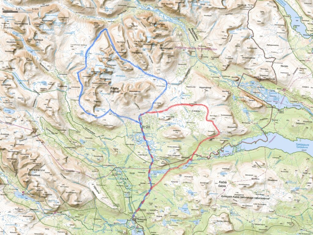
I changed the route in the camp in Pårek on day 2. There were 3 reasons for this: First, the weather forecast called for 14-20 millimeters of rain and low visibility for the next 2 days. In addition, the previous stages uphill from Kvikkjokk, with 28 kilos in the rucksack, were really hard and the prospect of even harder stages in the mountains was funnily enough not as attractive as when I planned the route. Last but not least, 2 Swedish guys came down from the same route and were not impressed: “It went fine, but it was just rocks and no green at all!”. The Swedes’ disappointment became the decisive argument for changing the plan.
I decided to lay the route in valleys between the mountains and shorten the overall route to make the day stages more manageable, with my heavy pack. At the same time, I let the route hit the Kungsleden to the north-east by the Rittak valley in order to gain more kilometers on an easier and marked route.
It was a bit of a defeat that I didn’t get to go on a mountain trip, but it changed my trip from being strenuous to being manageable. I had some fantastic days in Sarek and the trip back to Kvikkjokk was varied with many nice viewpoints and passages.
A trip into the middle of Sarek’s mountains is still high on my list of hiking destinations and it will hopefully succeed at some point.